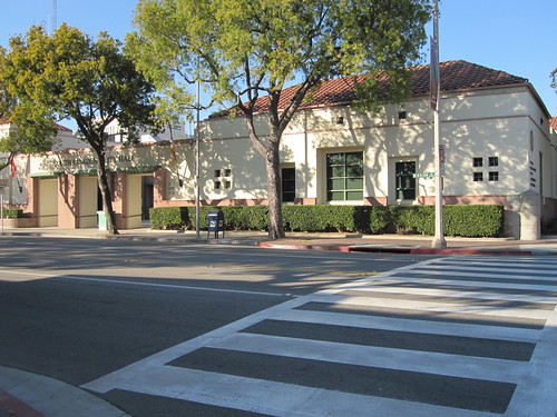
A new zebra-stripe crosswalk in front of South Pasadena’s city hall.In Los Angeles County it is easy to get distracted by the flash, and the piles of moving cash, in the City of Los Angeles. Yet the real action often happens in one of the 87 of other cities in the county – from scandals in the small cities in South East LA like Vernon and Bell to shining examples for what passes as bike -friendly planning in cities like Long Beach.
Add to that list of shining examples of bike planning the City of South Pasadena, which is right in the middle of a transition from a car-only to a people-first policy of mixed modes of transportation and traffic calming. This small city is leading the way with bike planning, a flush reserve account, and as solvent a government as any in Los Angeles County.

Postcard featuring the Opera House Building and Post Office building on Center Street (which would become El Centro in 1908) in South Pasadena, CA. From South Pasadena Public Library.
South Pasadena is a small city wedged in between Los Angeles and Pasadena, founded by residents wanting to distance themselves from the sin and vice sloshing around Pasadena in the 1880’s. Well, that and they wanted a bigger stake in their collective future. The city is well known (at least locally) for its 19th and early 20th century homes and traditional, human scale, small business districts. The small town is also well known for it’s opposition to freeway projects – being the last holdout opposing the construction of the 110 freeway in the 1930’s and stalling the extension of the 710 freeway for over a generation in the courts.
That is pretty serious street cred when it comes to opposing automobility. Yet, like most American cities, South Pasadena succumbed long ago to the mandatory motoring age on its small local streets – turning over expansive swaths of the carriage way to high speed private automobile travel and parking.
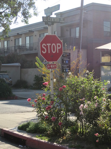
The corner of El Centro and Meridian – the 710 freeway would have bulldozed through.
I regularly ride to, from, and through South Pasadena. Trying my luck on the main roads in South Pasadena like Fremont, Mission, Pasadena Avenue (which connects to York Boulevard in Los Angeles), Fair Oaks, and Huntington Drive always leaves me ticked off at how quaint the architecture is, yet how brutal the roads are for anyone daring to walk or ride a bike.
I took some time recently to talk with Dennis Woods, the new Transportation Manager for the City of South Pasadena to find how some of the auto dominance in South Pasadena is being mitigated by their brand new Bike Plan – passed just a few months ago, in August of 2011.
Woods is used to working on projects like this – having recently helped another small city, West Hollywood, complete their Bike and Pedestrian Plan. Woods also spent time at Metro (LA’s countywide transportation authority), working on bicycle issues in their Countywide Planning and Development Department.
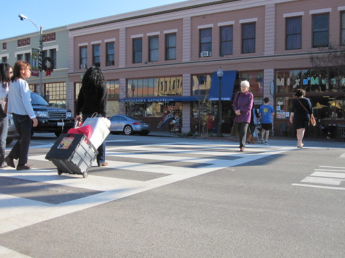
Pedestrians crossing the zebra stripe crosswalk at Mission Street and Meridian Avenue in South Pasadena
In the past two years, South Pasadena has turned federal transportation dollars into traffic calming treatments in two major business corridors along Mission and Fair Oaks. The changes came with some controversy. Construction made traffic on these streets come to a standstill at times. The intent of the finished project was to make it safer and easier for people to walk (and shop!) and harder for people to drive above 30 miles per hour through these dense commercial areas.
The next phase of this transition in South Pasadena’s streets is being enacted through the Bike Plan. Woods calls the plan, “[a] great opportunity to improve mobility – not only locally, but between cities regionally.”
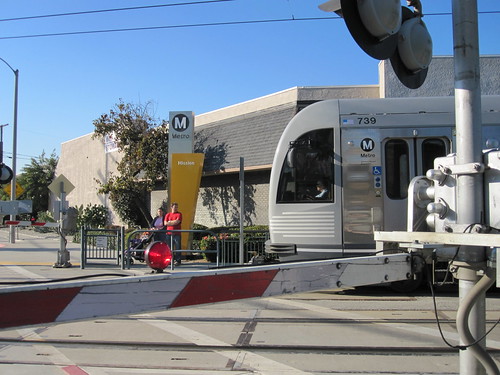
Cyclist and parents with a stroller wait for the Gold Line train to pass at Mission Station.
Woods mentioned the Gold Line station on Mission Street numerous times as a key to the Bike Plan, and the city’s transportation network, serving a larger goal of allowing more flexibility in resident’s travel choices. Mandatory motoring is being made optional in South Pasadena, one bike lane at a time, it seems.
South Pasadena consulted Los Angeles and Pasadena’s bike plans while writing their own. Woods informed me that neighboring small cities San Marino and Alhambra don’t have bike plans, but Alhambra is working on one right now.
It is common, at least in Los Angeles, for our city departments to regard public outreach with great antipathy, and cooperation with the small cities surrounding LA as the purview of officials of at least the rank of a U.S. Senator or ambassador.
South Pasadena’s bike plan reflects their vision for multi-modal city with regional connectivity – and they have begun implementing this vision in a hurry!
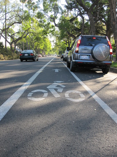
Bike Lane on newly paved Marengo in South Pasadena (heading towards Alhambra).
Marengo is a street that parallels the busy Fremont , running between Alhambra and South Pasadena’s business districts, with schools and parks dotted along its length. This was the first street to get a real, Class 2, bike lane – and the paint went down on fresh tarmac just a few months ago.
We’ve already used this route to visit a dim sum restaurant on one of our Dim Sum Rides. I’ve used it while visiting relatives in Alhambra – passing quickly through a beautiful, quiet, tree lined street in peace (for once!) in South Pasadena made a huge difference.
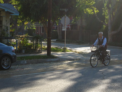
An older gentleman rides a bike on El Centro Street bike lanes on a quiet Sunday afternoon.
El Centro Street bike lanes in front of Arroyo Vista School in South Pasadena.
The next facility to hit the ground was a short stretch of Class 2 bike lane on El Centro. This is an ideal street to go to the Metro Gold Line station at Mission. With a good bike and a baby seat (like the Gazelle Bloom and a Yepp Maxi or Bobike Junior – all for sale at our shop, of course!) you can safely drop your kid off at school, then catch a train to the office; after work, you can get the kid, and some groceries, and head home without ever using a car – this is the heart of what Woods was talking about.
What is next?
South Pasadena has the best geography to ride a bike between Los Angeles and Pasadena, or Los Angeles and the San Gabriel Valley – but the roads that make this transition between regions possible stink if you’re riding a bike.

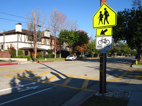
A clipping from the South Pasadena Bike Plan's bike network map.
As Dennis Woods and I spoke, the engineering work to reconfigure Pasadena Avenue (which is York Boulevard’s name as it crosses over the Arroyo Seco and the 110) was out to bid.
In 2009, the City of Long Beach led the way with their innovative green shared use lane on 2nd Street in Belmont Shore – and Woods is working on South Pasadena’s version of this type of lane on Mission Street as it passes by the Gold Line station and connects to Fair Oaks.

Bikes locked to a lamp post in front of Buster’s Coffee Shop in South Pasadena on Mission Street.
What does this mean for South Pasadena? They are a small city, but they have held fast to their values: local control, local needs, financial stability, and quality of life. Communities of a similar structure that hitched their horses to Los Angeles and Pasadena rode the wave of rising and falling fortunes in the 20th century – giving up historic property, their human scale, and financial solvency.

South Pasadena’s bike plan represents another step in the right direction for this small city. Hopefully, the big kids in LA County will look down from their jet airplanes, hungover from a party with campaign donors the night before, while they are flying to Sacramento, Wall Street, or Washington, DC to beg for more money and loans; they will look down and see a solvent city, a beautiful place to live, to work, a place that strives to embody the best of what being together in a city means.
8 Comments
Great article about a great plan–but I too ride S. Pas. regularly, and one thing I really find lacking is bike parking. Even Buster’s, which typically has two to six bikes parked there, has not one rack; neither does the bakery on the other end of the block, nor the coffeehouse across from the library square. People already bike a lot in that sweet little town, but there’s no secure & convenient bike parking except at the Metro stop–which is for folks who are leaving town for the day!–and I think a couple of racks on Fair Oaks.
Parking is one of the cheapest forms of bike infrastructure, and one of the most necessary. Networks without destinations won’t get much use. See if you can talk Mr. Woods into heaps of bike racks. (I suppose they’re already in the plan, which i need to reread, but they didn’t rate a mention when you spoke to him, which worries me.)
He did mention it, but I was focused on lanes and the City’s larger vision in my interview. Bike parking is covered in Chapter 4 of the plan (on pages 47 and 48 of the .pdf). The plans are basically to add racks at every important civic and cultural structure in the city (parks, libraries, city hall, post office, horse stables, schools, shopping district, YMCA, etc.). At the Gold Line, city hall, library, and gold course they are planning to install bike lockers. Additionally there is a proposed ordinance to require any new development over 15,000 sq ft. to provide bike parking (however, seeing how developed South Pasadena is already, I wonder how effective this will be).
In either case, they are trying to sync bike parking with land use. We’ll have to see how that phase of the plan is implemented, however, as bike parking typically falls short in the details of implementation.
I agree with Richard. Bike parking is a major issue everywhere! As a South Pasadena resident, I use my bike to run errands around town every weekend. I think it was a nice gesture, but a lack of real understanding to spend money on bike lanes first. This did NOT change anything for us local cyclists. We always used El Centro and Marengo as alternatives to Monterey Road and Fremont Avenue. It does help cyclists from other cities navigate through our town, but did not improve our riding experience one bit.
If we have bike parking in the Mission and Fremont commercial districts, THAT would make a big difference. As you see in your own photo, we are mostly forced to lock our bikes to light posts and street signs. That’s a real annoyance for the cars parked on the streets next to us and fuels conflict between motorists and cyclists: Nobody likes to open their passenger door and be blocked by a bicycle.
Cyclists will always find the fastest, safest routes through a city. We don’t need stripes on the street to do that.
What we DO need is a place to park once we’ve reached our destination. Did you know that the Music Center downtown has ONE bike parking rack? So does MOCA. If there is any bike parking in Japantown, we haven’t found it. Nor is there any parking at the Alhambra farmer’s market in the (now defunct) Mervyn’s mall parking lot. And here in lovely “bike friendly” South Pas, I cannot safely park my bike at the Vons or Pavilions grocery stores. Clearly, if city planners were cyclists they would be aware of these problems. As a property-owning taxpayer, I’d be happier if they spent our tax dollars on steel, not paint.
Louise,
You are, of course, correct – but this plan is rolling forward quickly and bike parking is a big part of it. Design and engineering for the more politically sensitive corridors in South Pasadena is underway now, and the city hasn’t wasted any time in building it’s first facilities once the plan was approved.
I wouldn’t have taken such a positive tone if I hadn’t seen things progress so rapidly, if I hadn’t read the city’s bike plan and budget and seen that the city can afford to execute it’s vision, and if I hadn’t talked to a very smart and hard working guy in charge of making these changes happen.
I think South Pas. could use a bike coalition of its own to make sure that your interests are taken care of. Maybe we can help get that started somehow?
Isn’t South Pasadena the city that is proposing 24 miles of bikeways over the course of 20 YEARS? It is rather ridiculous to have such a long time line for such a small city and such a small number of bikeways, regardless of funding. South Pasadena had plans in the past that resulted in near nothing– why not have a shorter time line for these 24 miles of bikeways? It seems bicycling is not really a priority when bikeways will be implemented at about a mile a year for 20 years.
Severin,
Really?! I just read through the plan, and spoke with this guy Dennis Woods about their plans to do some fairly big projects for such a small town – mentioned above in the post. The city is only 3.4 square miles, so 1 mile/year spans a considerable portion of town. Additionally, the city seems to be fairly good at not spending more than it has. Maybe this fiscal austerity is part of what means the plan will roll out slowly.
I will need to do some more research to find out when all this great stuff is allegedly going in! Thanks Severin.
Just looked at the Bike Plan, plan divided into 3 Tiers– Tier 1 will be implemented between 1 and 5 years. Tier 1 includes Pasadena/Mission, Fair Oaks, El Centro, Meridian, Huntington, Fremont, Oak, Montery. Most of these are classified as being bike lanes or bike routes with Mission as LB style green lane. Good priorities and I’ll do further investigation myself before I accuse the city of being non committal.
PS, If you’ve seen it, that’s my brown Gazelle in the shop : )
Having taken a closer look at the Plan, the city seems committed and organized but I am disappointed that intersection design doesn’t look beyond bike boxes and bicycle detection loops. Also, no mention of cycle tracks beyond one reference to a portion of Monterey Road.
It also seems there are opportunities to have bike lanes that are wider than 5 or 6 ft but the conceptual designs insist on center turning lanes being 12′ and motor vehicle lanes being 11′ (when in fact both could be 10′ and in some cases make cycle tracks a viable option or at the very least a wider bike lane).
Fair Oaks is an interesting case in that it now has a 6ft gutter for part of it. I cycled on it over the summer and just assumed the whole gutter lane (which was very smooth) and felt little pressure from cars driving beside me. However, on the rare occasions it does rain it seems cyclists will be forced to share with motorists. Also, Fair Oaks as 10′ motor vehicle lanes, further proving my point that other streets in the plan don’t need a superfluous 1 or 2′ for cars which could be turned over to 1) move bike lanes out of door zones or 2) have wider bike lanes 3) buffered bike lanes or 4) if we are really ambitious cycle tracks.
On Fair Oaks between Monterey and Huntington conceptual design shows three motor vehicle lanes at 11′ with a 5′ bike lane and 8′ parking. If motor vehicle lanes were reduced to 10′ that’s 3′ extra that could be used to enhance bicycle travel at no reduction at the number of motor vehicle lanes.
Anyway, as far as plans go, this appears one to be optimistic with and what has me really excited is the Edision easement which could allow the creation of a high speed, car-free travel but careful attention needs to be given to the 7 crossings along the way.
Thanks for the excellent, exciting article!
One Trackback
[…] You’ll probably have noticed by this time that the character of the neighborhood is quite different from the starting point. You are now in the City of South Pasadena. South Pasadena broke away from Pasadena in the 1880′s and is chock-full of college educated people living in well-to-do early to mid-20th century homes. It is a quiet town, which has recently begun overhauling its streets to make the more bike friendly. […]