In a recent interview with KCET Departures, outdoor survivalist and native foods expert Christopher Nyerges described the path of the Arroyo Seco River from the LA River, through Highland Park, to Pasadena as a prehistoric highway – moving goods, culture, and people. Today, the Arroyo Seco Parkway (aka “110 freeway”) has paved over the trails of aboriginal peoples of the region, conveniently connecting Pasadena to Highland Park and the greater Los Angeles area for those driving cars.
What has been great news for people driving cars has become bad news for those of us that ride bikes. How do you get from Highland Park to Pasadena on a bike? There are lots of different routes, but I’ve got one that has become my “North East Passage” – avoiding as much car-only ugliness as possible, passing through beautiful areas and streets, and sidestepping as many grueling climbs as possible on the way from Highland Park to lovely Old Town Pasadena.
This ride is a moderate difficulty climb from Highland Park to Old Town Pasadena. The start point is convenient to the Metro Gold Line Heritage Square station and the 81 and 83 Metro bus lines (which run 24 hours). Total cost for the day if you arrive by bike and pack your own lunch: $0. Free parking at the Flying Pigeon LA bike shop if you want to arrive by car (and then leave on your bike).
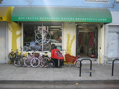
The start of the North East Passage, for me, is always at the North East LA (aka “NELA”) bike industrial complex at the corner of Avenue 37 and North Figueroa Street – where my bike shop, Flying Pigeon LA, and the bike repair collective the Bike Oven are located. The street address is 3404 N. Figueroa St., Los Angeles, CA 90065.
So, let’s get mounted up and riding!
View North East Passage in a larger map
Heading North on North Figueroa for one block, hang a right on East Avenue 39. One block down and you’ll swing left onto Midland Street, a quiet residential road that T’s into a jungle of native plants behind chain link fence at East Avenue 42. That jungle of plants is the back side of the Lummis Home – a local landmark and former home to one Charles Fletcher Lummis, LA’s first librarian and an important figure in local and regional history.
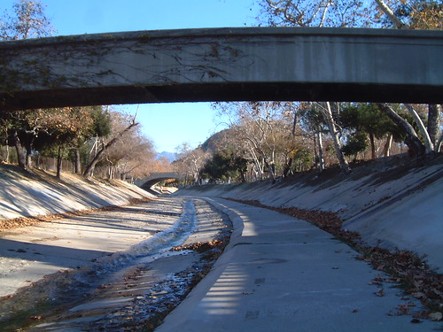
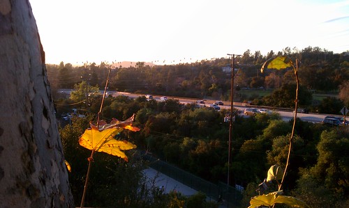
A right turn on East Avenue 42 and a left onto Carlota Boulevard (a right-of-way that parallels the 110 Freeway) will deposit you at the Avenue 43 on- and off-ramps to the 110 freeway. This “parkway” was under construction in the late 1930’s, and if you look closely you’ll see the year the bridge was completed stamped into the walls.
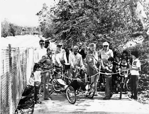
“Dedication of Arroyo Seco bike path ca. 1983”. This low-resolution image is from the collection “Shades of L.A.: Mexican American Community” housed at the Los Angeles Public Library. It depicts City Councilman Art Snyder (holding scissors with boy) at dedication of the Arroyo Seco bike path some time in 1983.
Turn right on East Avenue 43 over the bridge. Take the first left onto Mosher Avenue. This will take you to the parking lagoon for Montecito Heights Recreation Center. Off to the left of some dumpsters you’ll spot a cement path – the beginning of the Arroyo Seco Bike Path!
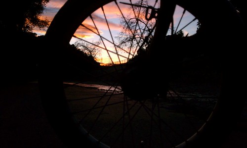
The Arroyo Seco Bike Path was completed in the 1980’s and runs for about 2 miles in the river bed of the Arroyo Seco.
Riding along the cement lined walls of the Arroyo, you’ll have a chance to appreciate the geography of the region, and the multiple overlapping periods of human habitation. On your right looms the hills of Ernest E Debs Regional park, home of the Audobon Center. To your left, the noise of rushing water and high speed freeway traffic.
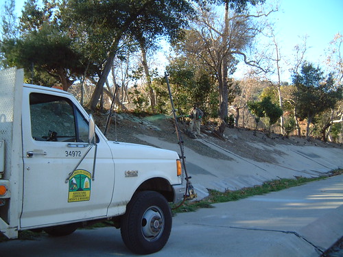
LA County worker spraying the walls of the Arroyo Seco bike path with green-tinted glyphosate and other herbicides.
The high walls of the cement-lined Arroyo are the canvas for local taggers, and a workplace for the County’s paid graffiti cleaning crew, each one wiping away the work of the other in a weekly cycle of reinterpretation and redefinition. The Arroyo is also home to a team of herbicide spraying County workers, literally painting the walls of the Arroyo green with toxic chemicals to keep plants from cracking the walls of the flood channel.
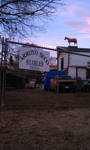
As the Arroyo Seco Bike Path ends, the scent of horse manure and the crow of feral roosters will beckon you up a ramp and into the parking lot behind the Arroyo Seco Stables. The stables are a reminder of the area’s pastoral legacy. People keep horses here to preserve their heritage, plus horsies and chickens are cute.
Ride out of the parking lot and hang a left onto Marmion Way. There is a short, steep, climb up to Pasadena Avenue. Make a right on Pasadena Avenue. On your left, hidden behind the trees, is a golf course and driving range. There is also a great foot path that starts at the intersection of Pasadena Avenue and Marmion Way if you want to walk the rest of the way to Pasadena on a narrow dirt trail.
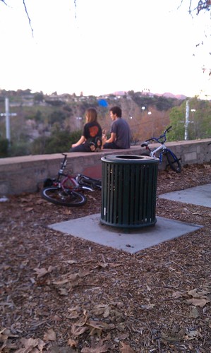
Up a short distance ahead is Arroyo Drive – turn left here. Arroyo Drive will curve off to the left and cross a span of bridge over the Arroyo and the 110 freeway. This is a nice spot to stop and catch a view of the region looking South West towards Downtown Los Angeles (the benches are at the intersection of Arroyo Drive and Arroyo Vista Place). If you are riding with someone you like, this is the place to kiss (just don’t linger, the neighbors might get annoyed).
Cross over the bridge and hang a right onto Sterling Place, then a quick left on Grand Avenue.
You’ll probably have noticed by this time that the character of the neighborhood is quite different from the starting point. You are now in the City of South Pasadena. South Pasadena broke away from Pasadena in the 1880’s and is chock-full of college educated people living in well-to-do early to mid-20th century homes. It is a quiet town, which has recently begun overhauling its streets to make the more bike friendly.
Grand Avenue doesn’t need much to be made more bike friendly – it is wide, well
paved, low traffic, and provides a gentle incline as you make the transition from the riparian valley below to the foothills of the Angeles National Forest in Pasadena. Stay on Grand Avenue, which will turn into Arroyo Drive for a brief patch. Keep your head up! You don’t want to miss the Y in the road up ahead. Veer right, back on to S. Grand Avenue.
Pretty soon you’ll see a bump up ahead. This is the worst part of the trip! A few hundred yards of actual hill climbing on your bike … oh no! Trust me when I say this: this is the easiest climb of all the other alternative routes in the area.
Make a right on W. California Blvd., crossing over Orange Grove, passing Singer Park on your right, you’ll come to the intersection of California Blvd. and S. Pasadena Ave. On the corner is the massive Huntington Memorial Hospital.
Hang a left onto Pasadena Ave. – be mindful of the zombies driving cars here. Most of them are trying to slam on the gas in the left-hand most lane to enter the freeway. You will want to stay on the right hand side of the road. In a block or so, a bike lane will magically appear under you wheels.
Another couple of blocks still, and you’ll be deposited at the corner of S. Pasadena Ave. and E. Colorado Blvd. – also know as the western tip of Old Town Pasadena!

The return trip to LA is always an easy one, since it is downhill the whole way. You also have the option of hopping on the Gold Line at one of several stations in Pasadena to return to Heritage Square station at the NELA bike industrial complex.
Before you go, hop off your bike, find a watering hole, and enjoy! You made the journey from Highland Park to Pasadena, from low river valley to the foothills, past the living history of Highland Park, NELA, and Pasadena.