Yesterday, I attended the city’s quarterly Bicycle Plan Implementation Team meeting, and among the many questions with which I annoyed the good folks from LADOT and City Planning (during what must have been a long two hours for them) was one about wayfinding. This, as regular readers will know, is a subject dear to my heart—for what good are bikeways, when we get them, if you can’t find your way to where you want to go on them, for want of decent signage?
It’s hard for any one person to be intimately familiar with all the scattered neighborhoods of a city as vast as Los Angeles; even if you’re not a visitor, you may get lost following our bikeways now and then. Yet so often bikeway signage consists of nothing more than a flimsy tin rectangle stating that you are on a bike route or path, or in a bike lane. Which you probably already knew; the stripes aree kind of a giveaway&hellip.
When I’ve explored the bikeways of Portland, San Francisco, the East Bay, or Denver, I’ve been pleased to find that there are clear and informative signs letting you know what popular destinations lie how far off in which direction. Neighborhoods, shopping areas, rivers and hills, other bikeways, all listed on discreet but very obvious signs.
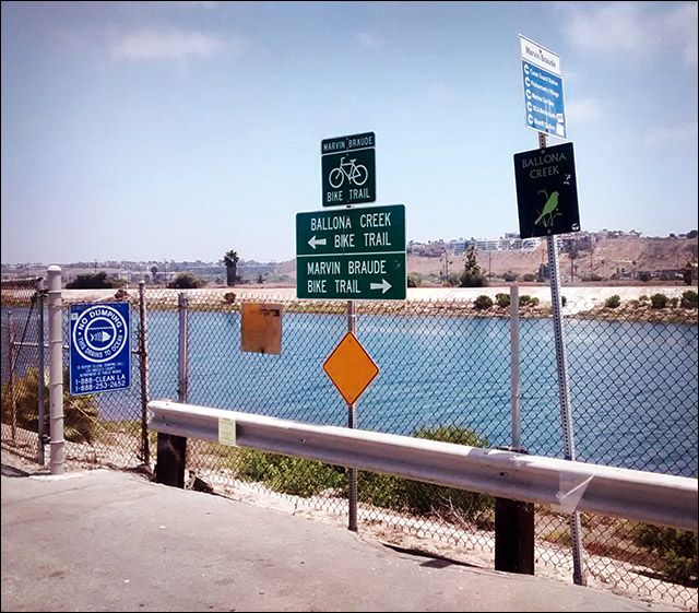
We have a few of these in the LA area, though most of them are not in the City of Los Angeles. The array of signs in the photo is on LA County land, in Marina del Rey. It is, however, very good, though a bit of a stylistic mishmash: one sign clearly indicates and names the two bike paths that intersect at this spot; another names the creek by which one is riding; and a third names nearby destinations, such as the shopping strip, the Coast Guard and Sheriff’s stations, and the Marina.
The best wayfinding I’ve seen so far in the city has been on the Chandler bike path connecting North Hollywood to Burbank. And some new signs have popped up along the Los Angeles River bike path in Elysian Valley—but those were placed by the Mountains Recreation and Conservation Agency, not the city.
But at the BPIT meeting, I finally received an answer I could be happy with: the LADOT has budgeted for a citywide wayfinding project, to improve (or in most cases simply add) signage along bike routes, lanes, and paths.
We know how LA works, so there is a likelihood that the effort will take a long time to implement, or may simply peter out, if we don’t keep nagging LADOT. But apparently it’s now a public commitment—which in itself is a sign that we’re headed in the right direction.
2 Trackbacks
[…] Meanwhile, LADOT has completed 50 miles of road diets in the last 15 years, and has finally budgeted for a citywide network of bicycle wayfinding signs. […]
[…] Someday L.A.’s Planned Bike Signage Will Arrive (Flying Pigeon) […]